
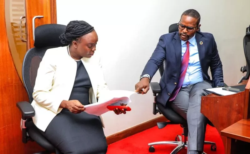
 Environment CS Dr Deborah Barasa and PS Festus Ng'eno during a past event/File.
The government on Wednesday announced that El Niño was firmly established and the possibility that it will spill over to February next year is 100 per cent.
Environment CS Deborah Barasa told the media at the Kenya Meteorological Service Authority that the October–November–December rainfall season will come with potential hazards.
“The potential hazards are clear: riverine flooding that can displace communities, destroy homes and crops, cut roads and bridges, and contaminate water sources; flash floods that strike with little warning and claim lives; urban flooding that inundates homes and businesses, overwhelms drainage and disrupts power and telecommunications; lake flooding and backflow that threaten lake shore settlements and fishing livelihoods; landslides and mudslides that bury homes and isolate communities,” Barasa said.
The CS toured the Service to check on the ongoing Modernisation before updating the country on preparedness for the Upcoming El Niño.
Barasa cited other hazards to include lightning, severe thunderstorms and hail that kill, injure and damage property and crops; strong winds and marine hazards that endanger boats and coastal infrastructure; and dam or water-pan overflow that can send sudden floods downstream.
“These are the risks we must prepare for and the opportunities for water storage and production where rainfall is well managed,” she said.
A wetter-than-normal October-November-December 2026 is anticipated across much of Kenya, with prolonged wet spells and isolated heavy storms.
Barasa said the move arises from the interaction of rainfall intensity and duration with river and lake levels, terrain, exposure, vulnerability, and the condition of drainage and infrastructure.
“A wetter season does not automatically mean floods everywhere. Flooding occurs where hazard meets exposure and vulnerability, including in urban areas with inadequate drainage, even when seasonal totals are not exceptional,” she said.
Barasa assured the public that forecasts and warnings will continue to be issued and updated; that information will be disseminated through multiple channels; that national and county structures are coordinating preparedness.
She said the ongoing modernisation of KMSA is a deliberate investment in reducing the human and economic cost of extreme weather.
“I urge every citizen, every farmer, every local authority and every stakeholder to follow official KMSA forecasts and advisories, and to take recommended early action. Timely information, combined with preparedness, remains our most effective defence.”
Barasa said KMSA will progressively refine the picture through monthly, weekly and daily forecasts, down to nowcasts and severe-weather warnings as the season unfolds.
The CS said the government is putting in place measures to protect the public.
“Preparedness is organised under the four pillars of Early Warnings for All: risk knowledge; observation, monitoring and forecasting; warning dissemination and communication; and preparedness and response.”
She said awareness is being raised.
The CS said the office of the Deputy President has been coordinating preparedness, readiness, and response plans.
Barasa said anticipatory action and response will be delivered through multiple partnerships including national and county governments, the National Disaster Operations Centre, the Kenya Red Cross Society, humanitarian and development partners and the World Meteorological Organisation among others.
The agencies together support early warning, anticipatory action for El Niño, contingency planning, and last-mile reach to farmers and communities at risk.
Barasa urged Kenyans to take advantage of the coming rains to grow more trees in line with government’s ambitious initiative of growing 15 billion trees.
During the briefing, meteorological experts pointed out that the strength of El nino was gaining momentum, meaning that it could even be stronger than the 1997 one.
Service’s acting Director Edward Muriuki saidscientific evidence indicates that the El Niño signal is strong and still intensifying.
“The Indian Ocean Dipole, which is another important driver, is currently neutral. Such a strong El Niño can substantially alter temperature and rainfall patterns across many parts of the world, increasing the likelihood of impacts, including floods, drought, and extreme heat.”
Muriuki said the strength of an El Niño event alone does not determine how severe the impact will be in any individual country or region.
Its effects vary according to the location and season, and can be modified by other climate drivers, including conditions in the Indian and Atlantic oceans.
“That is why we keep mentioning a Nino and also the Indian Ocean Dipole, which are the main drivers that are likely to influence the season.”
He added: “Since the El Niño signal is strong, I would like to reiterate that the expected rainfall conditions may not necessarily be like 1997.”
Muriuki said that during the 1997which is amongst one of the strongest El Niño events, the Indian Ocean Dipole was also very strong.
For Kenya to receive high rainfall records, a positive IOD, combined with strong El Niño conditions, enhances the possibility of above average to enhance rainfall over most parts of the country during the October, November, December season.
Muriuki said the forecasts show a near 100 per cent likelihood that it will persist through February 2027.
He said a very strong El Niño can significantly shift rainfall and temperature patterns worldwide and fuel extreme weather.
“Exceptional weather demands exceptional preparedness and response. Early warning should lead to early action and anticipatory planning.”