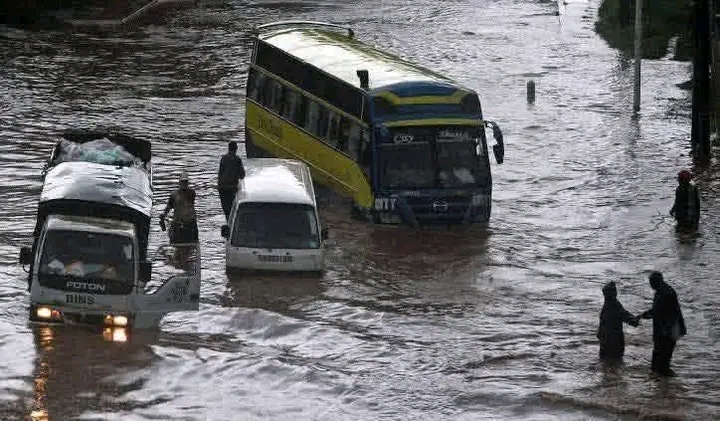
Every time heavy rainfall hits Nairobi, the city quickly experiences flooded roads, stranded vehicles and disrupted businesses.
Images of submerged streets in areas like the central business district and residential estates often circulate widely on social media, sparking public frustration.While the debate often turns political, researchers and urban planners argue that Nairobi’s flooding is primarily the result of natural geography combined with decades of structural changes to the city’s landscape.A City Built on Slopes and ValleysOne of the main factors behind Nairobi’s flooding lies in the city’s natural terrain.
Rainfall that falls in higher areas of the city such as Spring Valley, Lavington, and Kilimani naturally flows downhill through river channels and drainage corridors.These water pathways connect to major rivers including the Nairobi River, Ngong River, and Mathare River.From there, the water moves toward lower parts of the city such as the Nairobi Central Business District, Industrial Area Nairobi, and Embakasi before eventually draining toward the Athi River basin.Because of this natural slope, rainfall from several neighborhoods can converge quickly into the same drainage channels.Drainage Systems Designed for a Smaller CityAnother major challenge is that Nairobi’s storm-water drainage network was originally designed for a much smaller population.Historical planning during the colonial period assumed a city of fewer than half a million people.
Today, however, the Nairobi metropolitan area hosts well over five million residents.As neighborhoods expanded and new developments emerged, the volume of rainwater flowing across the city increased dramatically.
However, the underground drainage infrastructure did not expand at the same pace.Urban planning experts note that roads, shopping centers, residential estates and parking spaces have multiplied over the decades, yet much of the original storm-water system remains unchanged.Disappearance of Natural Water Absorption AreasNatural landscapes once played a critical role in absorbing rainfall across the Nairobi region.
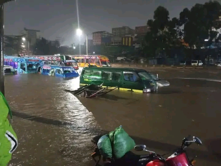
Nairobi Floods // Facebook
Historical planning during the colonial period assumed a city of fewer than half a million people.
Today, however, the Nairobi metropolitan area hosts well over five million residents.As neighborhoods expanded and new developments emerged, the volume of rainwater flowing across the city increased dramatically.
However, the underground drainage infrastructure did not expand at the same pace.Urban planning experts note that roads, shopping centers, residential estates and parking spaces have multiplied over the decades, yet much of the original storm-water system remains unchanged.Disappearance of Natural Water Absorption AreasNatural landscapes once played a critical role in absorbing rainfall across the Nairobi region.Wetlands and seasonal flood plains existed in places such as Eastleigh, Donholm, and parts of Embakasi.These landscapes functioned like natural sponges, allowing rainwater to spread out and gradually soak into the ground before reaching rivers.Also Read: Nairobi Floods: 4 Dead and City Gridlocked by Heavy Rain
Over time, however, many of these areas were replaced with buildings, roads and paved surfaces.
When soil is covered by concrete or asphalt, rainwater can no longer seep into the ground.
Instead, it flows rapidly across surfaces, increasing the amount of runoff entering rivers and drainage channels.Rivers with Less Room to FlowUrban development has also reduced the natural space available for rivers to expand during heavy rainfall.Sections of rivers such as the Nairobi River, Ngong River, and Mathare River were historically surrounded by wide flood plains that allowed water to spread safely during intense storms.Today, many parts of these river corridors have narrowed due to construction, settlement and accumulated debris.
With less space to carry large volumes of water, rivers overflow more easily when rainfall intensifies.Urban Runoff and Blocked DrainageUrbanization has significantly increased surface runoff in Nairobi.
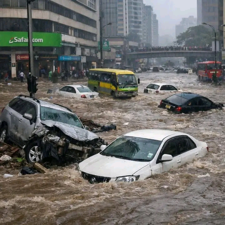
Nairobi Floods // Facebook
Hydrology studies show that as cities become more built-up, rainwater moves across surfaces much faster than it would in natural landscapes.
What might once have been a manageable storm decades ago can now produce far larger flows entering the same drainage channels.
Additionally, drainage systems often become blocked by plastic waste, soil from construction sites and other debris.
When storm drains and channels are obstructed, even moderate rainfall can quickly overwhelm the system.
A Complex Urban Challenge
Taken together, these factors explain why Nairobi often floods during periods of heavy rain.
The city’s natural geography channels water from higher elevations toward lower zones, while decades of urban development have reduced the landscape’s ability to absorb rainfall.
At the same time, aging drainage infrastructure struggles to handle the increased volume of runoff produced by a rapidly expanding metropolis.
Urban planners note that addressing flooding in Nairobi requires long-term structural adjustments, including improved drainage capacity, restoration of natural water corridors and better management of urban runoff.
Until such structural changes occur, flooding is likely to remain a recurring challenge for one of East Africa’s fastest-growing cities.


Comments 0
Sign in to join the conversation
Sign In Create AccountNo comments yet. Be the first to share your thoughts!