
Nairobi Governor Johnson Sakaja has ordered the preparation of a response action plan in 48 hours to help address flooding, drainage failures, and infrastructure damage across the city.
He directed officials to prepare a report mapping drainage hotspots, identifying damaged roads and infrastructure, outlining the work required, the responsible agencies, and the cost so that repairs can begin immediately.
Sakaja issued the directive on Monday morning, after chairing the Implementation Committee on the Cooperation Agreement with national government agencies at City Hall.
Several Principal Secretaries and representatives from key national agencies met to focus on the worsening flooding situation caused by ongoing heavy rains.
The committee agreed to prioritise the repair and recarpeting of flood-damaged roads and discussed the installation of new street lighting in informal settlements, highways, and residential estates.
“The plan should allow immediate interventions to restore normalcy across affected areas,” Sakaja said while recommending the task be done with help from the Kenya Urban Roads Authority (KURA), the Kenya National Highways Authority (KeNHA) and the Kenya Rural Roads Authority (KeRRA).
"Look at the assessment already done by the County engineers. Get that validated by KURA, incorporate KeNHA and KeRRA to do some roads in the city. Let us look at what Google and ESRI can assist with," he said.
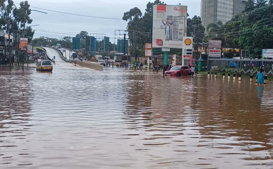
The meeting took place following a second round of heavy rains that caused widespread flooding in several parts of the city Saturday night, disrupting transport and prompting rescue operations.
Areas affected by flooding include Parklands, the Central Business District (CBD), Ngong Road around the Ngando area, Lower Kabete, Kibera, Kilimani, South B, Kawangware, Lang’ata, Lavington, Eastleigh and Riruta.
Already, state agencies have placed the death toll from floods at 66, with damage to property running into millions yet to be quantified.
The government has already identified 37 flood-prone areas in Nairobi as heavy rainfall continues to pound the capital and other parts of the country.
According to the Ministry of Interior and National Administration, the ongoing rains have significantly increased the risk of flooding in both urban and rural areas, with Nairobi emerging as one of the most affected regions.
Officials said the flood-prone locations were identified through a mapping exercise conducted under the Nairobi Rivers Regeneration Programme, which focuses on restoring the city’s river systems and improving disaster preparedness.
The mapping identified 37 neighbourhoods located along major river corridors and areas vulnerable to flooding due to their proximity to the Nairobi River and its tributaries.
In the Nairobi East corridor, areas identified as flood-prone include Kiambiu, Dandora, Kariobangi, Kayole, Komarock, Njiru, Ruai, Mwiki, Donholm, Savannah, Tassia and Fedha.
Many of these neighbourhoods lie downstream along sections of the Nairobi River and are susceptible to flooding when water levels rise.
In the western parts of the city, the ministry identified areas such as Madaraka, Nairobi West, Lang’ata, Kawangware, Kangemi, Lavington, Westlands, Parklands, Kitisuru, Spring Valley, Kileleshwa and Chiromo as vulnerable to flooding.


Comments 0
Sign in to join the conversation
Sign In Create AccountNo comments yet. Be the first to share your thoughts!