El Niño is expected to strengthen further before reaching its peak in December, with sea-surface temperatures in the central and eastern tropical Pacific forecast to hit record levels between October and December 2026.
The World Meteorological Organization (WMO) said the strengthening climate event is expected to influence weather patterns across the globe, with possible effects on economies, ecosystems and communities.
In its latest Global Seasonal Climate Update, the WMO said El Niño would continue to intensify during the October-November-December period.
“El Niño is firmly established and strengthening rapidly,” WMO Secretary-General Celeste Saulo said.
The organisation forecasts a near-100 per cent likelihood that the event will continue through February 2027. It said the event could potentially become one of the strongest since at least 1950.
The forecast is based on a consensus from 13 national and international centres using real-time exchanges of ocean buoy, satellite and radiosonde data coordinated by the WMO.
The Niño 3.4 index, which measures sea-surface temperature anomalies in the central-eastern equatorial Pacific, has already risen sharply.
The anomaly increased from an average of 1.6°C above normal in June 2026 to 2.5°C above normal in August.
For October to December, the seasonal average is forecast to reach about 3.7°C above normal, with the peak expected around December.
According to the WMO, this would be the highest level since observations began and would exceed the previous record of 2.6°C recorded between November 2015 and January 2016.
Saulo said the strength of the current event was linked to the amount of heat stored in the ocean.
“El Niño doesn't add new heat to the planet. It releases heat the ocean has already been storing beneath the surface,” she said.
“The ocean it's drawing from is the warmest we've ever measured it. There is simply more heat available to release,” Saulo said.
The developing El Niño is expected to contribute to above-average temperatures across large parts of the world during the October-December period.
The WMO said the forecast does not mean every location will experience above-average temperatures every day. Instead, it signals a greater likelihood of seasonal heat extremes and related impacts.
The organisation also expects significant changes in rainfall patterns.
Above-normal rainfall is forecast to be more likely across the Greater Horn of Africa, as well as parts of Central Asia, coastal East Asia, the northern Arabian Peninsula, parts of North America south of 45°N and southeastern South America.
In contrast, drier-than-normal conditions are expected over the Indian subcontinent, southern Central America, parts of the Caribbean and northwestern South America.
A broad dry signal is also forecast over the western Pacific and equatorial Atlantic, extending across the South Pacific towards the southern tip of South America.
The WMO stressed that the seasonal projections indicate areas where wetter or drier conditions are more likely and should not replace national or local weather forecasts.
Other climate indicators are also shaping the outlook.
A positive Indian Ocean Dipole is expected to reach its peak in October before declining. Its October-December seasonal anomaly is forecast at about 0.5°C.
Sea-surface temperatures in the equatorial Atlantic are also expected to remain above normal.
The strengthening El Niño comes after August recorded the highest global surface temperature for that month, according to monthly reports from the European Union’s Copernicus Climate Service, the US National Oceanic and Atmospheric Administration and NASA.
Global sea-surface temperature also reached an all-time observed high in August.
The WMO said it and its members are working to reduce the potential impacts of the El Niño event across different sectors.
National Meteorological and Hydrological Services and regional climate outlook forums are providing regular updates to decision-makers, while information is also being shared across the United Nations system and with humanitarian partners.
The organisation said the forecast increase in extreme heat linked to El Niño is among the issues being discussed at the Global Heat Forum in Bangkok, Thailand, which runs from October 6 to 9.
The event has brought together 600 experts to discuss ways of turning climate science into proactive, sustainable and effective solutions.
With El Niño expected to strengthen through the coming months, the WMO says the latest forecast provides an important basis for preparedness as countries assess the potential effects of changing temperatures and rainfall patterns.
IN KENYA
Kenya formally entered the October-December rainfall season, with the Kenya Meteorological Service on October 4 warning of wetter-than-normal conditions in several parts of the country and releasing county-specific dates for the onset of the rains.
Acting head of the Kenya Meteorological Service Authority Edward Muriuki said rains had started in parts of 24 counties, including the Coast, western Kenya and the Rift Valley, and would continue spreading to other areas.
He said the remaining counties would receive the rains this week or the following week, with Turkana and Samburu expected to be the last to experience the onset in the third or fourth week of October.
Muriuki urged farmers to rely on detailed forecasts issued by county meteorological officials because the onset and intensity of the rains would vary across regions.
“County-specific weekly and monthly forecasts are available from the offices of respective county directors of Meteorological Services,” Muriuki said.
Rains have already started in Nandi, Kakamega, Vihiga, Bungoma, Siaya, Busia, Baringo, Nakuru, Trans Nzoia, Uasin Gishu, Elgeyo Marakwet, West Pokot, Kisii, Nyamira, Kericho, Bomet, Kisumu, Homa Bay, Migori and Narok.
The Coast counties of Mombasa, Kwale, Lamu and Kilifi, as well as the Tana Delta, are also experiencing the onset.
In Marsabit, Mandera, Wajir, Garissa and Isiolo, rains are expected to begin in the first or second week of October.
Much of central Kenya and Ukambani, including Nairobi, Kiambu, Murang’a, Kirinyaga, Nyeri, Nyandarua, Laikipia, Embu, Meru, Tharaka Nithi, Machakos, Kitui and Makueni, are expected to receive the rains next week or the week after. Kajiado, Taita Taveta and inland parts of Tana River are also included.
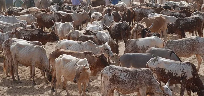
The Met said above-average rainfall could improve soil moisture, support land preparation and planting, regenerate pasture and improve water availability for livestock.
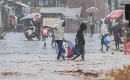
However, it warned that excessive rainfall could cause waterlogging, crop diseases, disruption of farm operations and difficulties transporting agricultural produce.
The agency expects particularly heavy rainfall in parts of the Coast and northeastern Kenya, including Kwale, Mombasa, Kilifi, Lamu and Mandera, as well as parts of Taita Taveta, Tana River, Garissa and Wajir.