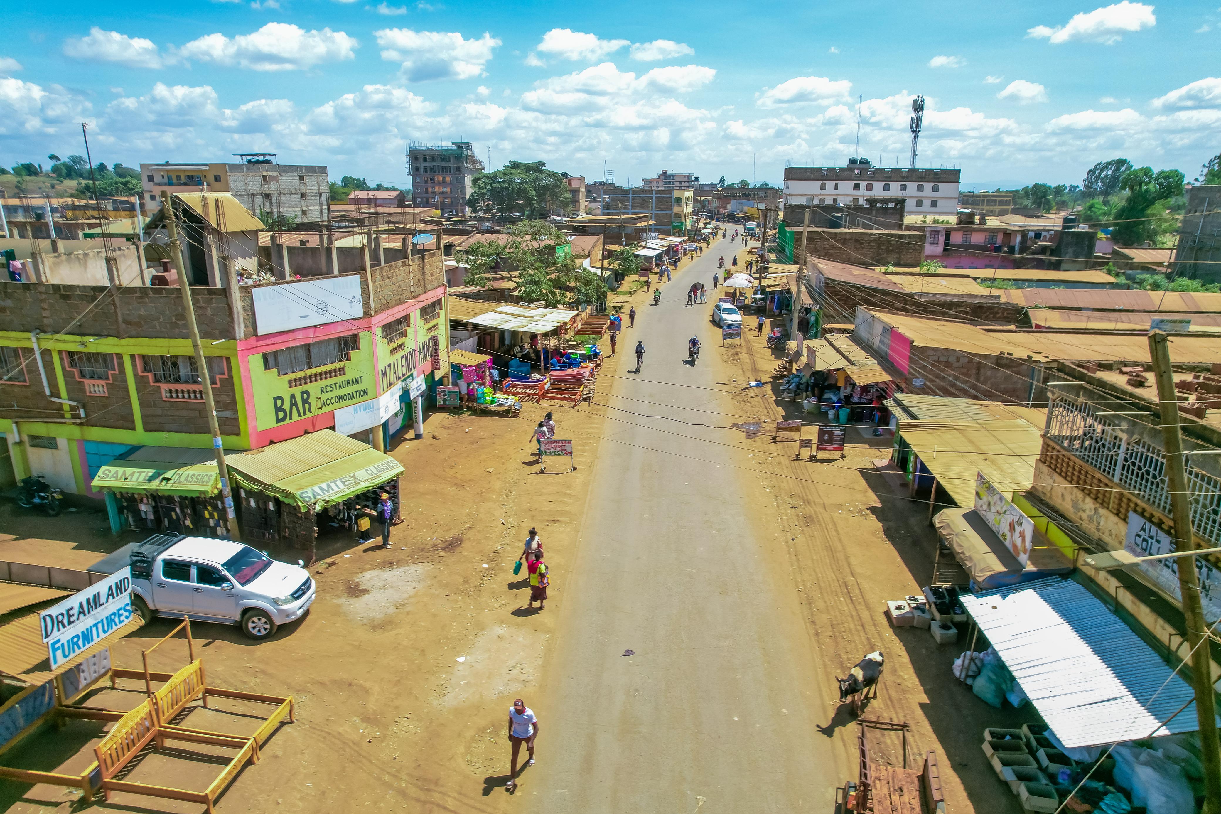
 Kagio town, one of the biggest and busiest towns in Kirinyaga county and which has benefitted from a digital land mapping exercise/ ALICE WAITHERA
Kirinyaga has rolled out a comprehensive digital land mapping and geo-referencing exercise aimed at restoring order in urban centres and resolving long-standing land allocation disputes.
The programme, now in its second week in Kutus and Kagio towns, is being implemented in phases. It is designed to strengthen urban planning, land administration and revenue systems across the county.
The exercise will extend to Wang’uru, Kianyaga, Kerugoya, Baricho and Sagana towns.
Lands, Physical Planning and Urban Development CEC Samuel Kanjobe said the programme is anchored in law to ensure compliance and transparency.
“By law, such an exercise must be guided by key documents including the County Spatial Plan and, for specific areas, a zonal plan. For the Kerugoya-Kutus municipality, we are using the Urban Economic Plan to guide this process,” Kanjobe said.
He said the ongoing pre-mapping phase involves capturing precise geographical coordinates for every plot.
“As we map the plots, we are picking their exact coordinates so that wherever you are in the world, you can identify where a specific plot is located and who the owner is,” he said.
Kanjobe said the mapping will make it easier to identify plots, strengthen development control and
improve revenue collection. He noted that while records indicate Kirinyaga has
more than 23,000 plots, the figure does not match the physical situation on the
ground.
Through the mapping exercise, the county will establish the actual number of plots and address ownership anomalies inherited from defunct local authorities.
“In Kutus, Wang’uru, Kianyaga, Kerugoya, Baricho, Kagio and Sagana, land was acquired for town expansion and original owners were compensated, particularly with alternative land in Mwea areas such as Gathigiriri, Marurumo, Dindiruku and Ngushu,” he said.
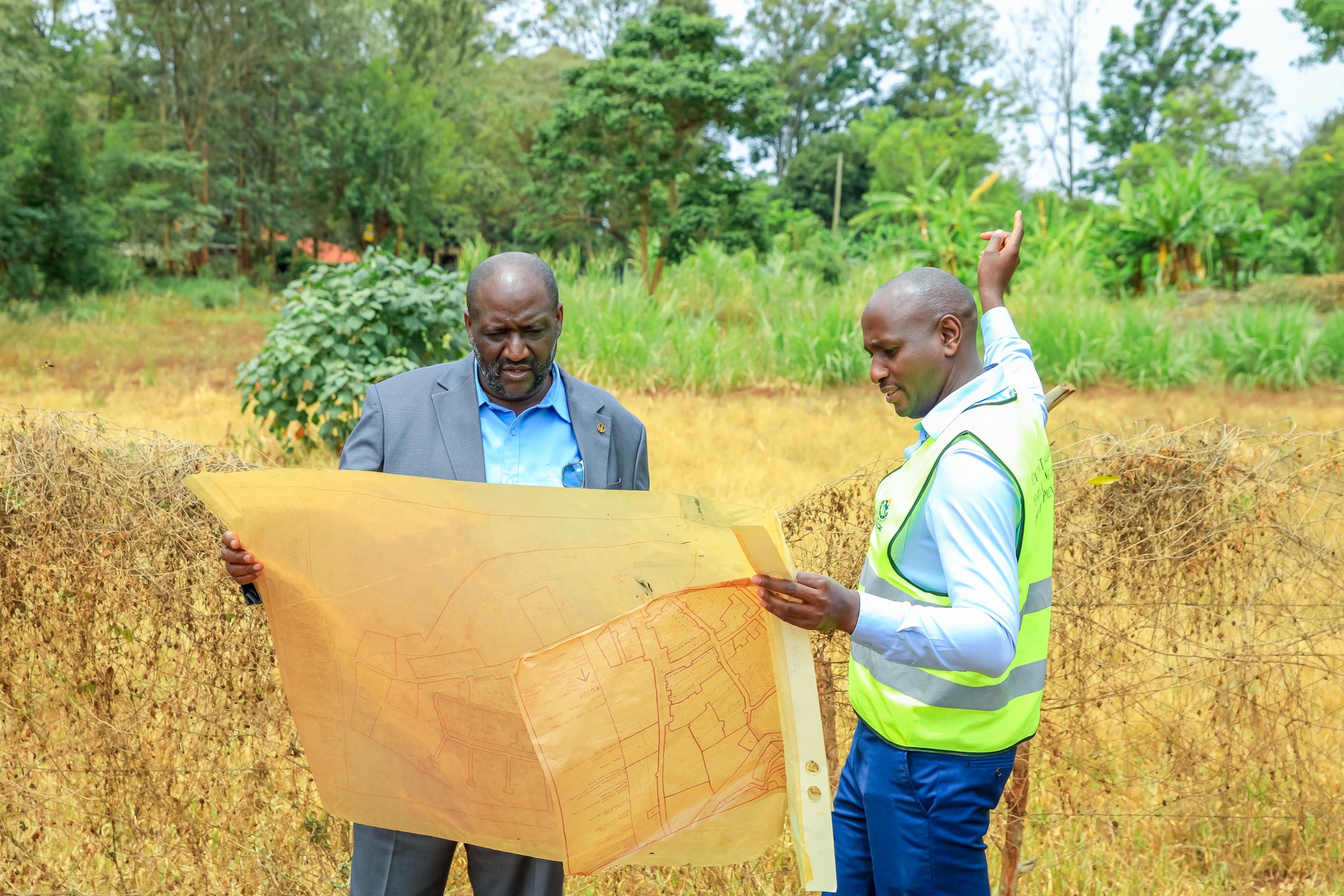 Kirinyaga Lands, Physical Planning and Urban Development CECM Samuel Kanjobe (left) leading a digital land mapping exercise in Kagio and its surrounding environs/ ALICE WAITHERA
However, surrender of title deeds was not always properly done, leaving some parcels under outdated registration regimes.
The programme will also address cases of double allocation that have caused disputes. In some instances, individuals only hold minutes from former local authorities instead of formal ownership documents. In towns such as Wang’uru and Kutus, some plots have multiple allottees, with some paying land rates while others do not.
“As the successor to the defunct local authorities, we bear both the assets and liabilities. We must regularise these parcels to protect genuine landowners and safeguard public interest,” Kanjobe said.
The digital mapping initiative complements ongoing efforts by the county government to safeguard and recover public land.
In recent years, the county has repossessed more than 800 acres of grabbed public land valued at about Sh1 billion. The parcels had been earmarked for hospitals, markets, police stations, schools, dams and other public utilities.
Governor Anne Waiguru said protecting public land remains central to sustainable development, noting that the mapping exercise will ensure every parcel is properly identified, owned and documented.
“Safeguarding public land from being grabbed is important because such land is meant to serve the collective good, not private interests,” she said.
According to the governor, proper land management supports infrastructure development, housing, industrial growth and environmental conservation.
Residents have welcomed the exercise, terming it long overdue.
Mugo Murage, a Kutus elder, said residents were sensitised before the exercise began to ensure they understood its purpose.
“It’s meant to help in urban planning and ensure that everyone retains their rightfully owned land,” he said.
Johnston Gitau Njoroge said the mapping has already generated vital data for infrastructure planning.
“It has helped us see where sewer lines are and where they should be, giving accurate information needed to plan a proper sewerage system for Kutus town,” he said.
George Ng'ang'a stated that local leaders accompanied county officials during fieldwork to build public confidence and enhance efficiency.


Comments 0
Sign in to join the conversation
Sign In Create AccountNo comments yet. Be the first to share your thoughts!