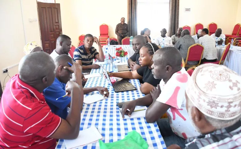
 Fisherfolk from Mombasa and Kilifi discuss a Sesa report for a Marine Spatial Plan in Mombasa on Friday /BRIAN OTIENO
Fisherfolk from Mombasa and Kilifi counties have lamented little or no inclusion in the development of Kenya's Marine Spatial Plan.
This, they said, leads to them almost always getting into conflict with authorities.
The small-scale fishers on Friday said they remain key cogs in the marine ecosystem and should not be ignored.
They said the Marine Spatial Plan (MSP) could negatively affect them if their views are not taken or considered.
The fishers spoke at a forum where they discussed the draft Strategic Environmental and Social Assessment (Sesa) report prepared as part of the MSP process and currently being circulated for public comment.
Said Hamisi, the Nyali BMU chairperson, said the government must involve all stakeholders in the marine ecosystem for there to be meaningful development in the sector.
He said the Sesa report shows small-scale fishers were not adequately involved when the groundwork for the report was being done, which could potentially hurt them if the report is implemented as is.
“If you want to implement something, you must first involve those who are going to be affected by that thing that you are implementing. If you did not involve them, it will be difficult for them to implement it,” Hamisi said.
He said the government is yet to take small-scale fishers as seriously as they deserve to be.
“Most of the fishers we have experience of up to 40 years. These are people that cannot be ignored. They have a wealth of indigenous knowledge that should be taken into consideration for any plan worth its salt,” the Nyali BMU chairperson said.
Community Action for Conservation of Nature (Canco) executive director Hadley Becha said small-scale fishing is rooted in local community cultural values, meaning it is a way of life.
They thus know which areas they need to get their resources from and which areas provide their workspace.
“That’s why Marine Spatial Planning is important for the small-scale fishers. Because there are areas where they get their fish and there are areas at shore where they do their activities, so landing sites should be part and parcel of the MSP,” Becha said.
He said there are so many other sectors at the Coast including tourism, conservation, maritime transportation, energy — like oil and gas development — among other infrastructural activities which are key to the country and which must be taken into consideration when coming up with the MSP.
“These are the types of economic development within the marine area or the blue space which must also be compatible with small-scale fishers, so that other small-scale fishers are not marginalised,” Becha said.
He said marginalisation comes when the areas where the small-scale fishers do their fishing and where they do their processing are not secured.
“As an organisation, we insist that small-scale fishers have these spaces secured for them in terms of titles of access,” Becha said.
He said if small-scale fishers do not have titles to their landing sites, the landing sites are prone to land grabbing, which denies them a decent livelihood or development opportunity.
Becha said five of the six counties at the Coast are dependent on the ocean.
He, however, lauded the government for the Sesa report, which lays the ground for the MSP, saying it is the first step towards ensuring small-scale fishers have a safe space within which they will do their work for generations to come.
“Those spaces must be secured by law,” Becha said.
The Canco executive director, however, said the Sesa report is silent on capture fisheries.
Capture fisheries refer to the harvesting of naturally occurring fish and other aquatic organisms from the wild in marine, brackish or freshwater environments.
“Where does that space begin? Does it begin at the low tide level or the high tide level or the riparian areas? What is the interface between the green space and the blue space in terms of land?
“Because we have coastal towns that are growing and I have not seen the implication of the growth of the cities, towns and settlements in terms of their demographics, expansion and the implication it will have in the blue economy space,” Becha said.
Kenya Marine and Fisheries Research Institute chief research scientist Jacqueline Uku, however, noted the government is keen to involve all stakeholders, including small-scale fishers, in the development of the MSP.
Uku, who is the MSP coordinator, said Kenya's ocean sustains millions of livelihoods, including in the fisheries, tourism, transport, energy and biodiversity sectors.
“Increasing pressure on marine resources and competition among users can lead to unsustainable use of these resources and conflicts among users,” she noted.
“Marine Spatial Planning (MSP) is essentially about deciding where different activities can take place in the ocean so they can coexist without damaging the marine environment.”
Uku said all fishing communities along the Kenyan coast have been engaged in the planning process and provided information on how they use the ocean space.
“Planners included the current fishing grounds and seaweed farming areas in the plan. They even went further and used scientific data to identify the areas where seaweed farming can be done sustainably,” she said.
“These areas will be clearly zoned in the MSP for seaweed farming. The MSP will also propose measures to protect these areas from other uses that can affect seaweed production.”
She, however, said a follow-up meeting will be held this week to iron out several issues and clear any doubts that some of the fisherfolk could still be harbouring.
Instant analysis:
All large development projects bring positive changes, but can also affect the environment and people’s lives and livelihoods. In developing such projects, the law requires that an assessment be done to identify potential negative effects and recommend ways in which they can be prevented or addressed if they occur. The Marine Spatial Plan (MSP) is no exception.