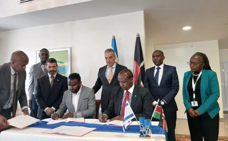
 Governor Mutula Kilonzo Jr (right) signs a Memorandum of Understanding (MoU) with AnyWay Solutions East Africa Regional Manager Solomon Nigusie (left). Israeli Ambassador to Kenya Gideon Behar (standing in the middle) witnessed the signing.
Makueni County has partnered with an Israeli company to use real-time satellite data to monitor the condition of its roads and determine where scarce road funds should be spent.
The technology, which also utilises Geographic Information Systems (GIS) and artificial intelligence (AI), will help the county do more than identify roads that need repair.
It will also help officials determine which road investments are likely to bring the greatest economic and social benefits while making communities more prepared for floods and other effects of climate change.
The partnership between Makueni and AnyWay Solutions was formalised on Friday at the Israeli Embassy in Nairobi, where Governor Mutula Kilonzo Jr signed a Memorandum of Understanding (MoU) with AnyWay Solutions East Africa Regional Manager Solomon Nigusie. Israeli Ambassador to Kenya Gideon Behar witnessed the signing.
Makueni is the first county in Kenya to adopt the technology, with Mbooni Sub-County serving as the pilot area.
Solomon Nigusie said the partnership was not simply about building more roads but making better choices about where to invest.
“At Anyway, we believe that one of the biggest challenges in rural infrastructure is not simply how to build more roads, but how to make better decisions about which road to prioritise first, especially when the resources are limited,” Nigusie said.
He explained that the technology would combine data with knowledge from people working in the county.
“By considering factors such as agriculture, population, access to market, schools and health facilities, as well as flooding and village risk, we can help identify where investment in roads can deliver the greatest economic and social impact. We will begin with the pilot in Makueni County, while also building the competitive country professionals so that the knowledge, tools and capability remain in Makueni,” he said.
The system will combine satellite images, GIS, rainfall information, open-source information and data held by the county. This will create a clearer picture of the condition and risks facing the rural road network.
Satellite images can give officials information about roads and surrounding areas without requiring them to visit every road. The information can then be analysed alongside data on population, farming, markets, schools and health facilities. Makueni is about 8,000 square kilometres large, nearly the size of Lebanon.
For example, a road serving a large farming area and several villages may receive greater priority than another road serving fewer people. A road that is frequently affected by heavy rains may also need better drainage or other measures to make it stronger.
The programme will begin by creating a digital picture of selected roads in Mbooni and identifying those that should be repaired or upgraded.
It will later introduce road asset-management tools and a digital dashboard that county officials can use to collect information, analyse roads and make decisions on maintenance.
Governor Mutula said the technology could help Makueni make better use of its limited resources.
“Makueni has 10,000 kilometres of earthen road. You can imagine the rest of the country. And if they can learn even a small thing from the technology Anyway offers, it will transform us.”
He said savings made through better road planning could be directed to other areas of development.
“It will help make good of resources and transfer them to something like agriculture or cattle rearing. So whatever it is that you think can help us, and there is nothing that will not help us that you know, please, even if it's growing of cactus, we have no problem.”
The technology will also focus on the effects of climate change. Roads can be damaged when heavy rains cause flooding, wash away soil or block drainage systems.
The engineering work will therefore look at drainage, water management, terrain and other factors that can determine whether a road can withstand extreme weather.
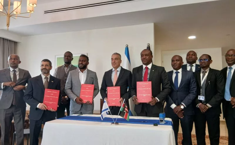 The officials after the MoU signing. AnyWay Solutions said its approach uses Earth Observation, GIS and data analysis to help governments understand transport networks and climate risks.
Israeli Ambassador Gideon Behar said roads were critical because they allow people and goods to move.
“We talk about how climate change is affecting Makueni, the anticipation of harder rains that would wash away roads…I think this MoU with AnyWay is really a good one because it enables you to know where to put your money, where to put your efforts to invest to increase roads efficiency and to prepare yourself for the eventualities of climate crisis,” he said.
The pilot will also include training for Makueni staff. This is meant to ensure that county engineers and other professionals can continue using the tools after the initial programme.
“A good network of roads which is also aligned with the environment and the protection of nature will both guarantee the development of the county and protecting the environment,” Behar said.
The technology is not intended to replace county engineers or local communities in deciding development priorities. Instead, it will give them more information to support their decisions.
AnyWay Solutions said its approach uses Earth Observation, GIS and data analysis to help governments understand transport networks and climate risks. The company has worked on transport and infrastructure projects in different parts of the world.