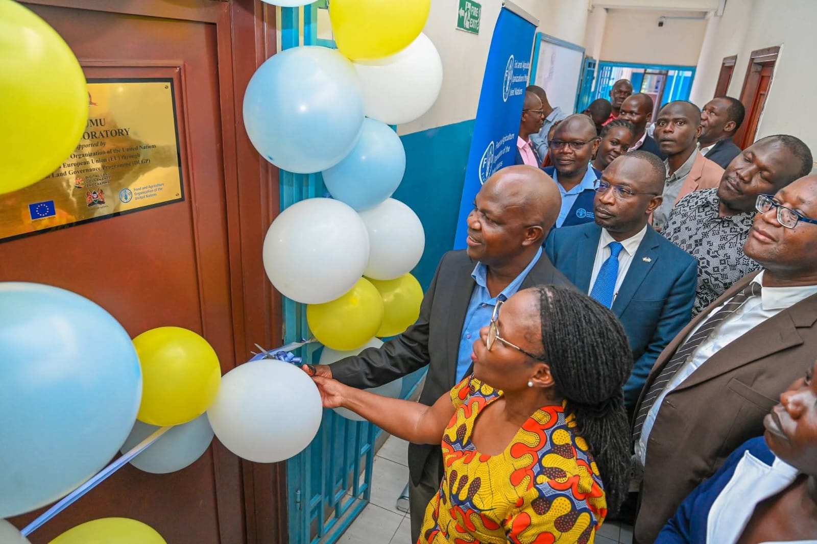
The Kisumu government has received a major boost in its push for data-driven governance after the Food and Agriculture Organization handed it a modern Geospatial Information System (GIS) laboratory.
The lab is expected to transform land management, planning and service delivery.
The facility was established under the EU-FAO Digital Land Governance Programme with funding from the European Union. It will support digital land governance, improve transparency in land records and help reduce disputes while strengthening agriculture, disaster preparedness and infrastructure planning in Kisumu.
FAO Representative in Kenya Farayi Zimudzi said the lab will enhance transparency, reduce land conflicts and support sustainable development.
“The Digital Land Governance Programme contributes directly to Kenya’s Vision 2030, the Bottom-Up Economic Transformation Agenda, and FAO’s strategic commitment to sustainable land management and food security,” Farayi said during the handover.
The total budget is 20.8 million euros(about Sh3 billion).
The programme aims to improve land-related service delivery, promote transparency, reduce disputes and strengthen climate-resilient food security and land-based investments.
Kisumu Governor Anyang' Nyong'o said the laboratory represents a major step in the county’s plan to embrace technology-driven governance and development.
His speech was read on his behalf by Deputy Governor Mathew Owili. Nyong’o said geographic information systems will guide evidence-based planning and support Kisumu’s ambition of becoming a smart city.
“Development in the twenty-first century must be guided by knowledge, informed by data and driven by innovation. Geographic Information Systems provide one of the most powerful tools available to modern governance,” the governor said.
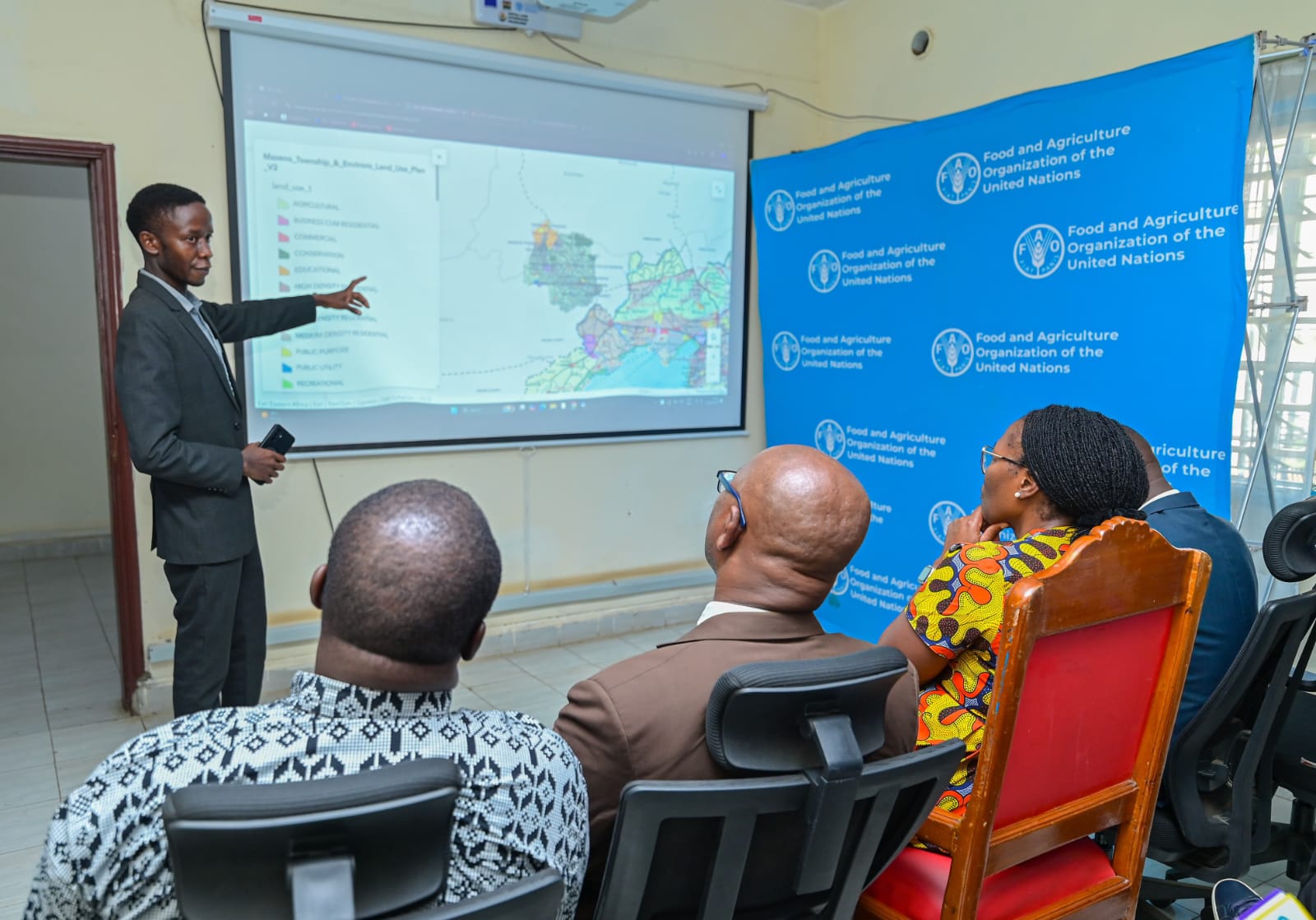
He noted that the system will enable the county to map resources, analyse land use and integrate data across departments to improve planning, infrastructure development and service delivery.
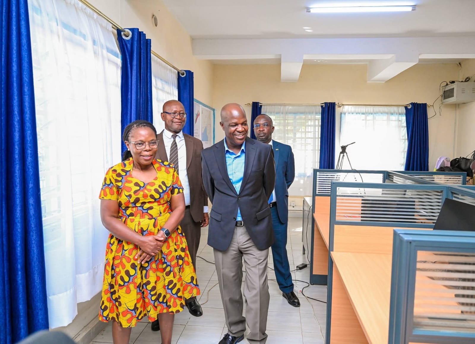
The GIS laboratory, currently housed at Kisumu City Hall, was re-established in 2024 after an earlier facility set up by the county government was destroyed by fire in 2019.
It is equipped with high-performance workstations, servers and data storage systems, large-format printing and scanning equipment, handheld GPS devices for field mapping and advanced projection systems for spatial data visualisation and planning.
Some 10 county officers drawn from different departments have been trained as GIS champions to ensure geospatial technologies are integrated across the county government.
Another six technical officers have received advanced training in GIS and remote sensing at the Regional Centre for Mapping of Resources for Development (RCMRD), strengthening Kisumu’s capacity to manage spatial data and apply it in development planning.
County officials said the investment is already supporting improved planning, monitoring and service delivery in key sectors including revenue management, fleet operations and digital health information systems. It is also aiding the development of an early warning system for disasters.
Nyong’o said the technology will also support agriculture by helping farmers make informed decisions through mapping of soil conditions, rainfall patterns and crop health.
“In agriculture, which remains the backbone of our rural economy, GIS will enable us to promote climate-smart farming and strengthen food security,” he said.
The governor added that GIS tools will also help the health sector map disease patterns, identify underserved communities and improve planning of health facilities.
He further noted that improved digital land records will enhance transparency in land administration and reduce disputes, a challenge that has historically affected many communities.
According to FAO, integrating geospatial systems with agricultural information platforms such as the Kenya Integrated Agricultural Management Information System will allow counties to better identify production zones, monitor land degradation, guide extension services and protect vulnerable ecosystems.
Nyong’o said the GIS laboratory will also serve as a knowledge hub for universities, researchers and young professionals interested in geospatial technology and digital mapping.
“As we launch this GIS Laboratory today, we are not simply opening a facility. We are embracing a new philosophy of governance, one that is transparent, accountable and driven by evidence,” he said.
He added that the facility will act as the central platform for spatial data in Kisumu through the establishment of a dedicated GIS unit and county geoportal, creating a reliable source of geographic information for planning and development.
“With this investment, we are moving from guesswork to data and from analogue maps to a fully digital future,” Nyong’o said.
Comments 0
Sign in to join the conversation
Sign In Create AccountNo comments yet. Be the first to share your thoughts!